

Sometimes it is difficult to understand the loss and potential damages that will occur with Industrialization of the Michigamme Highlands and ridgelines of the Huron Mountains. This is a Tour of just one location shows what is at risk of being forever destroyed. This is only one location, there are a proposed 54 to 68 more all different but just as remote and worth saving.
Turbine 18 Faa Information: 2018-WTE-6456-OE, T18, 46° 43′ 38.54″ N / 88° 11′ 31.82″ W
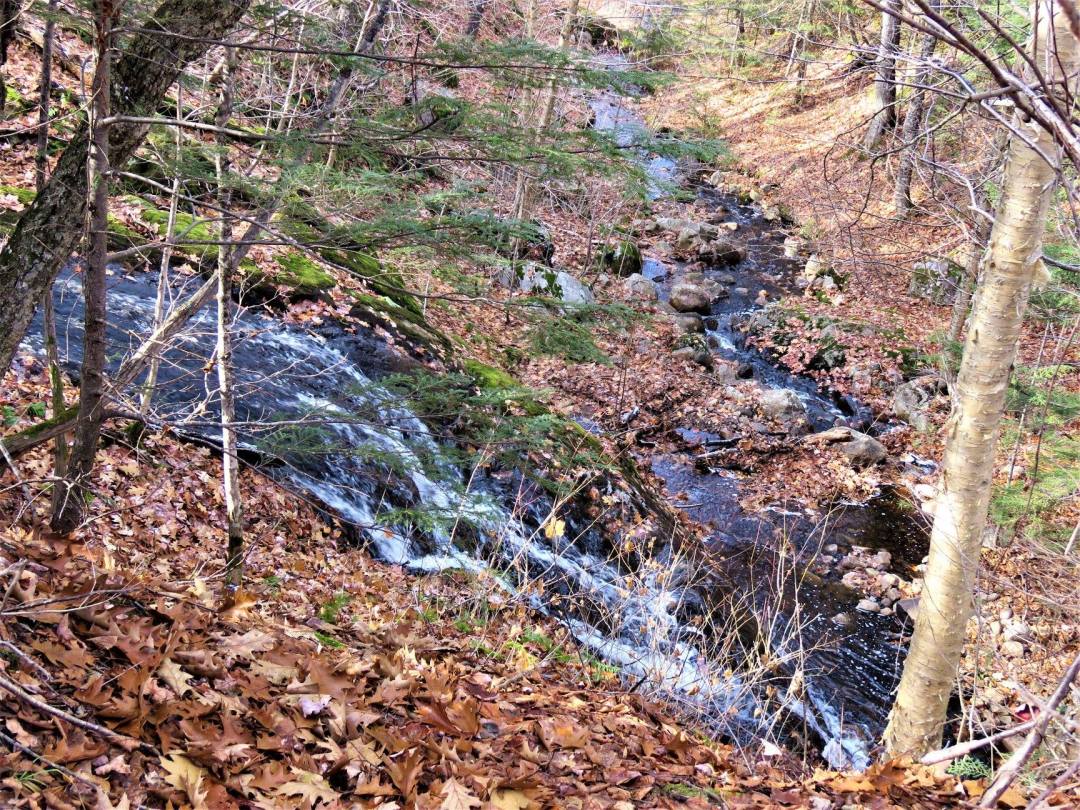
Proposed Turbine 18 up the hill and over a waterfall.

The ridgeline in the photo seen through the trees is the proposed location of T 18.
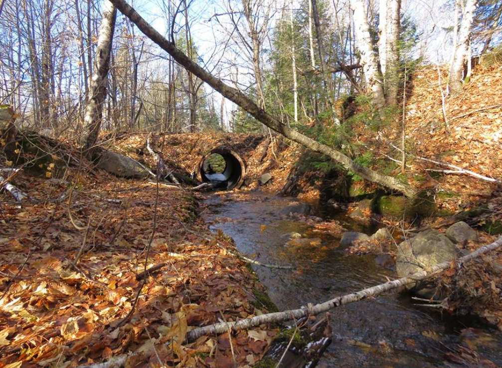
Located Right off the Huron Bay/Peshekee Grade

The road goes over the culvert-the tall waterfall is directly on the left of the culvert and on the right is a stream and small drops and then up the hill is the proposed Turbine 18 area. In case you saw the map of the sites but still couldn’t picture the reality.
Too close to proposed T 18. Call it a waterfall, a drop or something else. It is tall and beautiful-the stream takes a hard left and goes across the hill then takes another hard right and goes to a marsh.
Headwaters lake at risk located across the road from Turbine 18 proposed Location
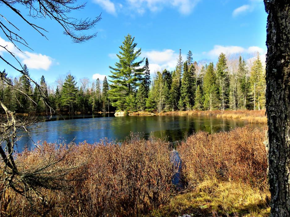
The watershed, wetlands and headwaters located across the “road” from Turbine 18 proposed location. The damage potential from 40 foot roads, soil compaction, clearing to the watershed and headwaters, would be devastating.


