FRIENDS OF THE HURON MOUNTAINS
2D Map and 3D Virtual Reality Web Viewer for Proposed Summit Lake Wind Farm
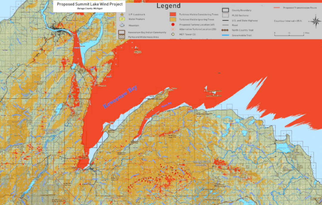
The 2D map highlights in dark orange every location where at least one turbine would be visible from a spot six feet above the ground, given current forest cover, in a direct line-of-sight to the turbine nacelle hub (278 feet). Blades are not included although they extend 221 feet higher because their orientation depends on wind direction. Winter or timber clear cut views also could be possible from the lighter orange areas.
Larger scale maps (including proposed roads and other features) are available. Request maps here.
To use the map in conjunction with the 3D Virtual Reality Viewer (VRV), follow these steps:
- Refer to 2D map for locations of interest.
- Access the 3D VRV.

Virtual Reality Viewer
- Enter desired viewing location in block at upper left.
- Click on thumbnail for indicated preset location. Vantage point is six feet above ground.
- Adjust date and time of day by clicking on the sun icon at upper right.
Download the Virtual Reality Viewer Instructions
With a little practice you’ll be navigating like a pro. Take an eagle’s-eye view to appreciate the scale of the destructive industrialization – imagine the 40 feet wide roads connecting the turbines – consider the damage to the environment, to tourism, to wildlife, wetlands and watershed. Visualize this repeated throughout the Upper Peninsula.
The Friends of the Huron Mountains is a nonprofit corporation formed to serve the common interests of visitors, residents, and friends of Baraga and Marquette Counties in Michigan’s Upper Peninsula. Contact us.
Press Release: FRIENDS OF THE HURON MOUNTAINS Virtual Reality Viewer
Related Posts:
